Marco de acción de datos abiertos territoriales en Madagascar
In Madagascar, territorial data faced limitations of access, articulation, and effective use, in a context where relevant information was distributed among different platforms, actors, and institutions. The challenge was to understand the real state of the territorial data ecosystem and translate that diagnosis into a practical roadmap to advance towards a more effective openness policy.
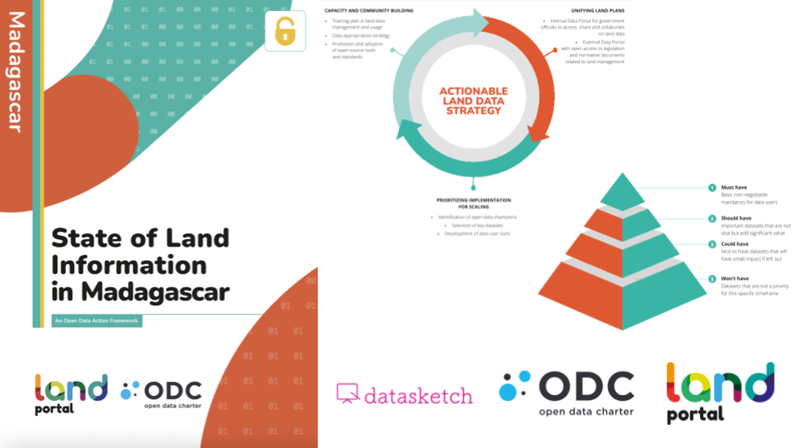
We conducted an analysis of the state of territorial data in Madagascar based on information gathering from the most relevant and official platforms, as well as interviews with ministries, civil society actors, and national specialists. The work concluded with an overview of the situation and a roadmap for the opening of territorial data, incorporating both a technical perspective and a series of concrete recommendations on how to advance effectively. The process culminated in the publication of a document that systematizes findings and orientations.
We analyzed the territorial data ecosystem in Madagascar and translated it into a practical roadmap to advance its openness more effectively.
The project produced a structured diagnosis and a clear route for strengthening territorial data openness in Madagascar, integrating technical, institutional, and governance dimensions into a useful proposal for decision-making.